Many local governments have long understood the importance of maintaining their tree canopies, but just over the past several years many cities in our country’s metro areas are creating standards to protect their trees using code of ordinances. Many of these codes require a detailed tree inventory as well as a quantitative method for monitoring tree canopies.
InterDev can provide your city with a 2-pronged approach to tree management and compliance with your tree ordinance.
1. Tree Canopy Change Detection – Using satellite imagery taken over the span of 3 to 5 years, we can provide a percent (%) change in tree canopy at the city-level and neighborhood level.
2. Tree Inventory Services – Using specification provided by the client, we will inventory all the trees necessary to fulfill the obligations of the City’s code. Specifications typically include an inventory of tree type, tree sizes, and accuracy of tree locations (sub-meter or sub-foot accuracy.)
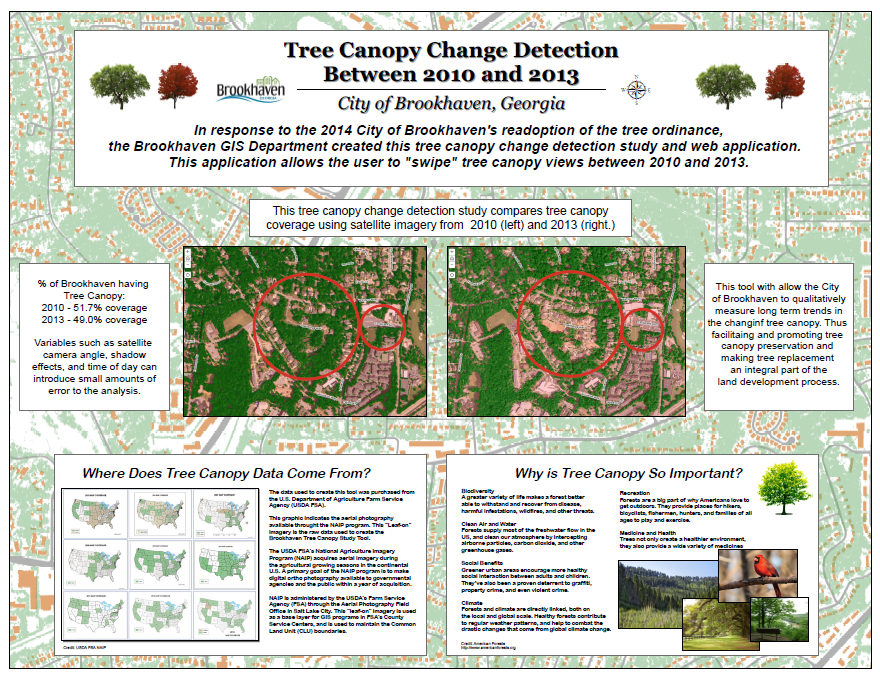
In response to the 2014 City of Brookhaven’s re-adoption of the tree ordinance, InterDev and the Brookhaven GIS Department created this tree canopy change detection study and web application. This application allows the user to “swipe” tree canopy views between 2010 and 2013. Click Here to view the Tree Canopy application.
The follow poster was created for the 2014 GIS Day event at DeKalb County, Georgia. This poster was created to promote a better understanding of the canopy change detection study.
To learn more about tree canopy studies and how we can help your city qualitatively track your tree canopy please contact me.
Mike Edelson, GIS Manager at 678-672-1528, or email me at medelson@interdev.com