
Our Work
Our GIS work goes way beyond basic mapping.
Showcase of Some of Our GIS Projects
We love highlighting our work! These are just a few examples of the variety of initiatives we can support.
Property Tax Dashboard
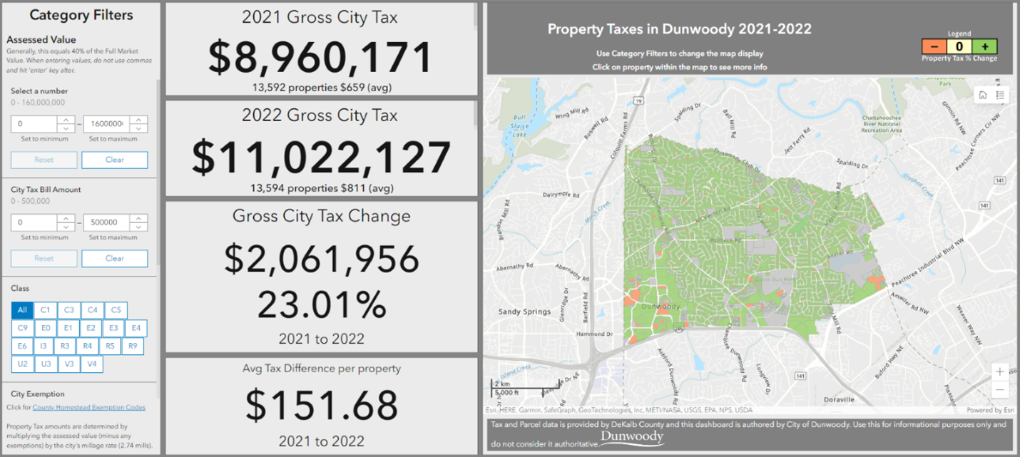
Updated in the fall each year, this provides detailed information used by City of Dunwoody, Ga officials to advocate for tax increases/decreases and assess impacts on tax revenue.
Capital Projects Information
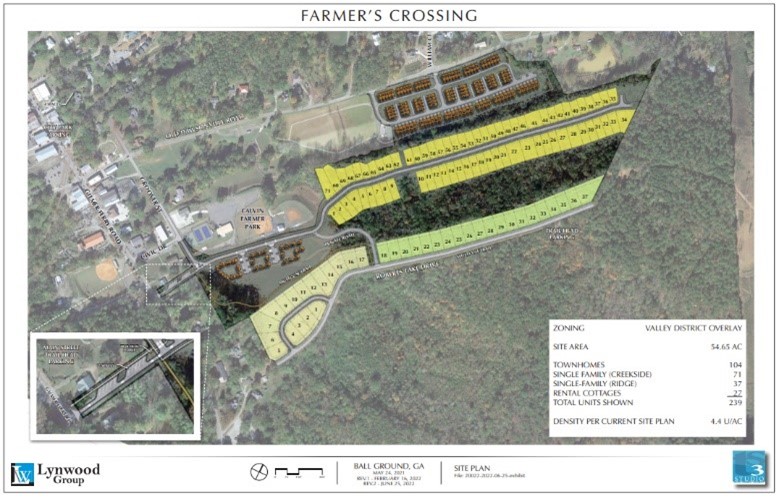
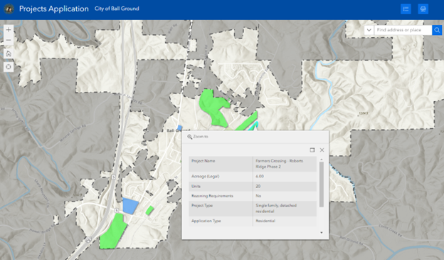
Informing City of Ball Ground, Ga staff and the public on the status of ongoing capital projects is something we help many clients do.
Visualizing in 3D
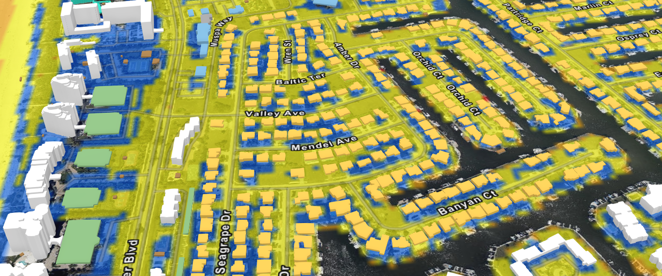
City of Marco Island, Fl hurricane damage assessment. This was a storm surge/flooding event with very little wind damage compared to less fortunate municipalities further north.
Stormwater Inspection Tools
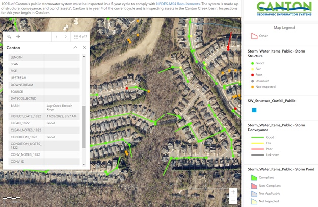
City of Canton, Ga staff rely on our GIS tools to inspect, monitor, and report on the condition of its stormwater system each year.
Zoning Information
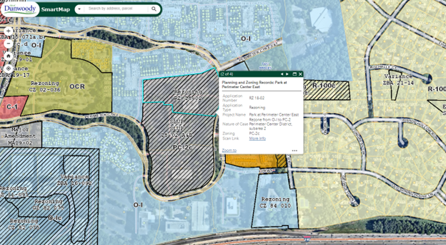
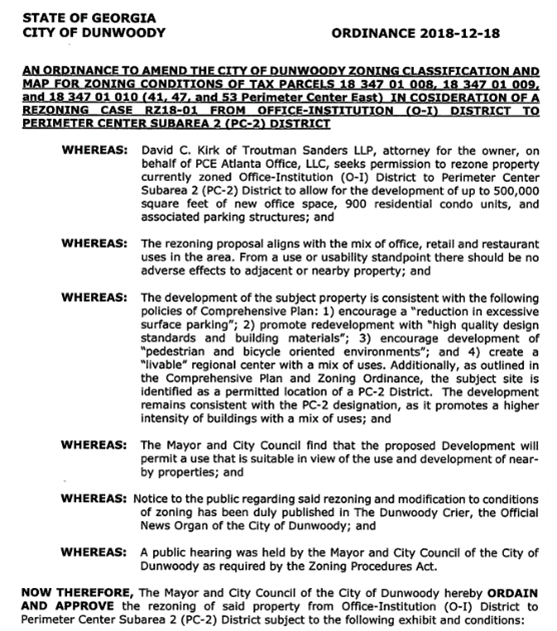
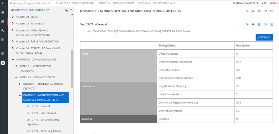
Dunwoody planners have access to everything they need to make informed land use decisions. No research. No digging. Fully catalogued and web-accessible documentation isn’t a luxury, it’s a necessity.
Public Art Display
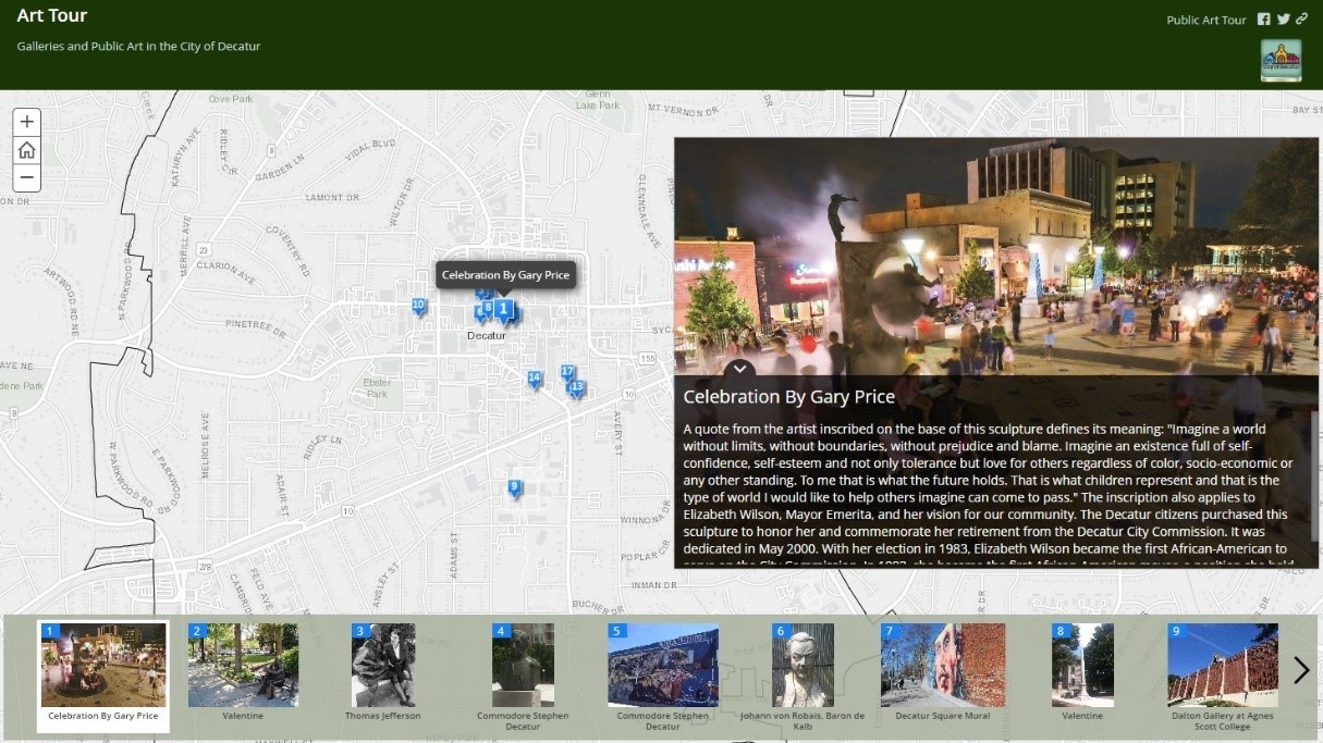
Public Art initiatives are popping up everywhere! This tool allows City of Decatur residents to explore art around the city.
Tree Canopy Study
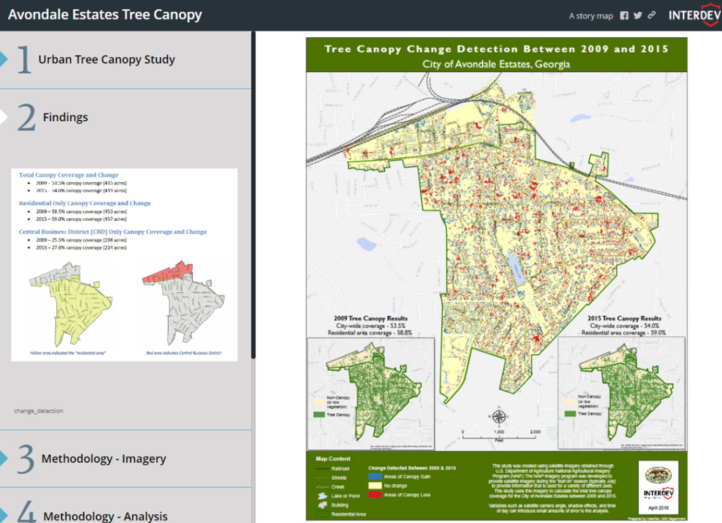
In Avondale Estates, Ga, we’ve studied tree canopy change extensively in the past and have embarked on updating this for 2023.
Get Feedback from the Community
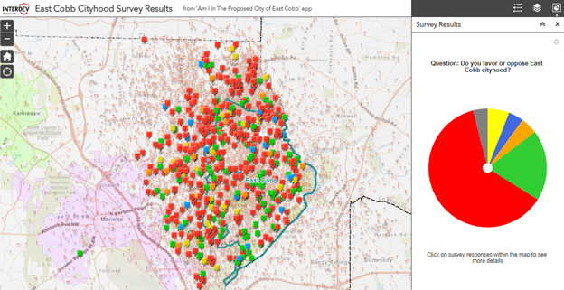
Prior to the referendum, we asked the East Cobb, Ga community if they favored or opposed cityhood. They answered a resounding ‘No’. The eventual referendum failed and these results echoed that sentiment.
Park Map
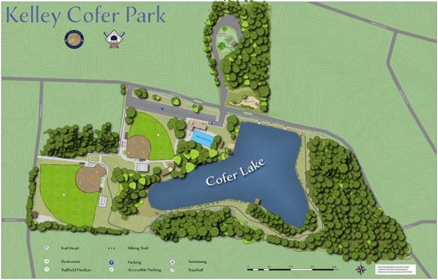
This beautiful map helps City of Tucker, Ga residents discover and navigate around this park.
Want to Know More?
Take the First Step
Let’s have a conversation to discuss what your needs are today, and where you want to be tomorrow. Our dedicated professionals will take the time to learn about your organization, understand its challenges, and address your concerns to get you the best possible outcomes.